
Sometimes the most scenic roads in life are the detours you didn’t mean to take.
Well, I can very well replace the word “scenic” with “daunting“, given how the unusual turn of events happened in the latest installment of my #travelfiascos series.
When and Where
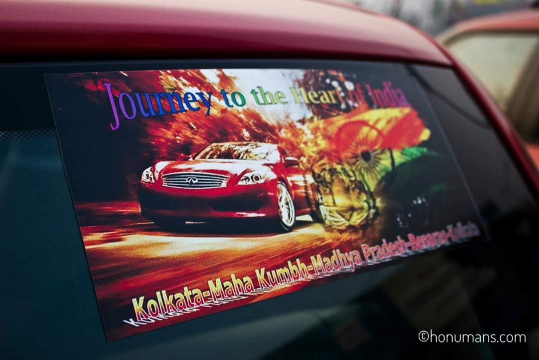
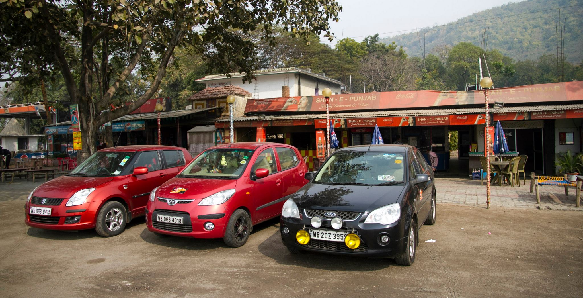
2012 was a milestone in Honuman travel history when we embarked an epic road trip to cover the heart of India – Madhya Pradesh. The travel log was like Kolkata-Allahabad-Khajuraho-Bhedaghat-Bandhavgarh-Varanasi-Kolkata. Three cars, a Fiesta, a Swift and a i10 being our rides.
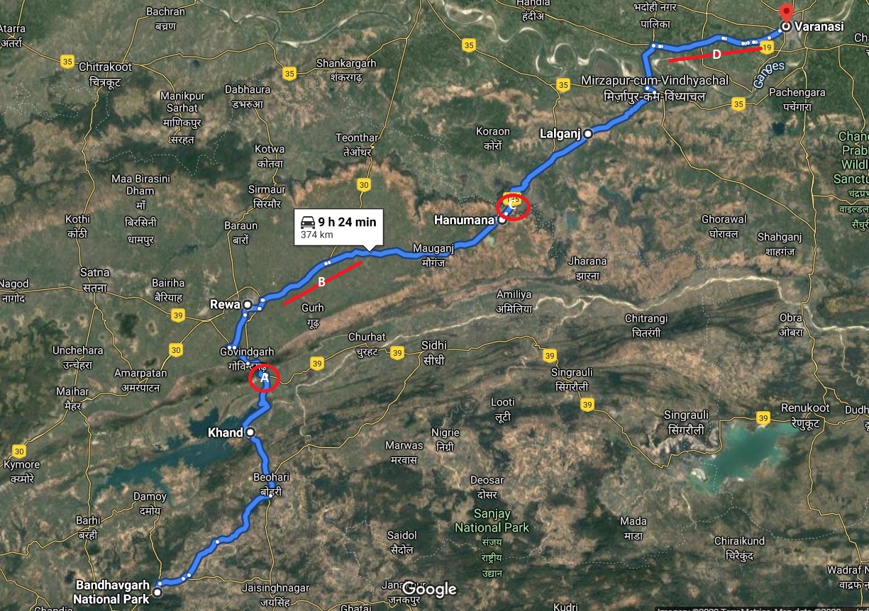
But this #travelfiascos is about the penultimate leg of our journey – Bandhavgarh to Varanasi. So see this Google Map view of the return leg and let the story roll.
P.S: Note the key markings (A-D) on the map for references in rest of the story
The line over “confidence”
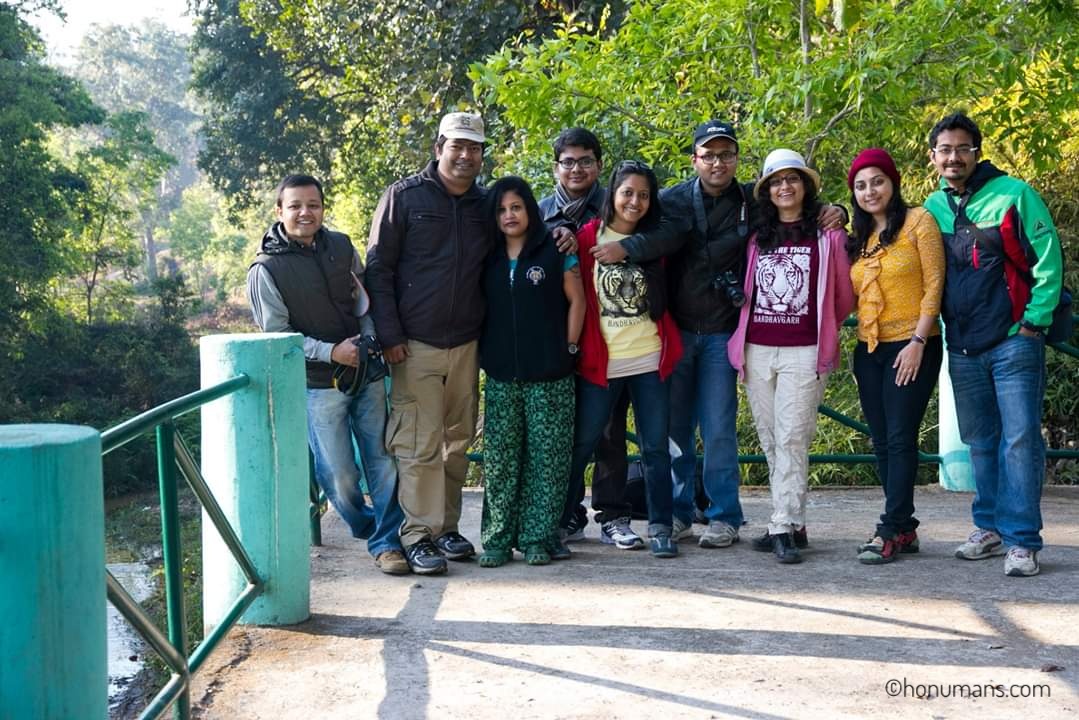
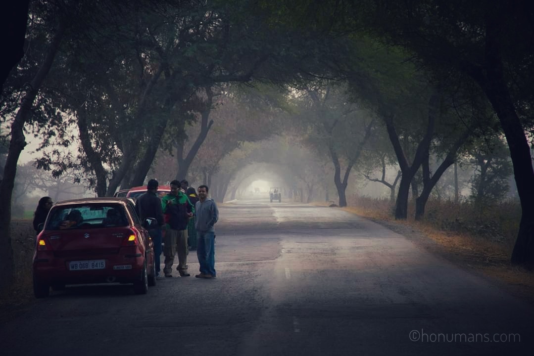
By the time, we were about to start from Bandhavgarh, we had already covered a distance more than 1500 kms on Indian highways without overshooting our ETA by a big margin. So on the penultimate day, we were pretty sure that 400 kms will easily be covered in 10 hours time and so we left the jungle at 7.30am. Here is us posing for the final time in Bandhavgarh and little did we know what lay ahead.
The gift of Indian highways
We were cruising at a comfortable speed, crossing Bansagar lake near Khand on our way to Rewa, when the gift of highway struck us. Left behind rock pieces used by truckers to prevent trucks sliding back, came in the way of our Ford Fiesta and a tyre burst and a broken alloy threw us out of our gear. Check point A in the Google map view above. Just before this happened, here is “all relaxed” us for a break before Khand.
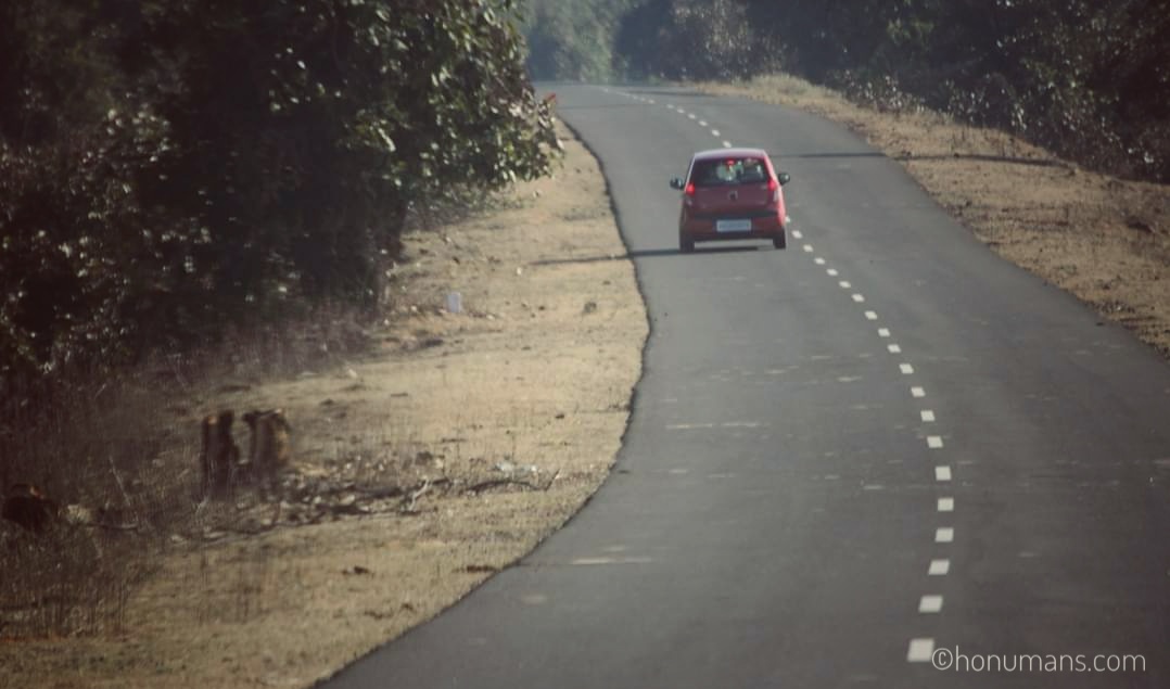
2pm and almost 3 hours was spent to find a good spare tyre in Rewa and our plans were starting to look not so glory. The not so good part came when we got to know that the road from Rewa to Varanasi had a bad patch of around 50 kms. We asked a truck wallah coming from that side and he replied, “Koi tension nahi!“. And thus we made the second mistake. Searching for the first? Will tell about it at the end. Better you catch below, the i10 blazing the highway before the next hurdle presented before us.
No roads to drive
Those 50 kms should rank among the worst roads we have traveled ever. No tarmac, no pitch, road turned into graveyard post a shower. We took almost 4 hours to cross those miles. It was getting dark and we were almost sure that Varanasi is going to be a tough call but we didn’t have much choice – due to the lack of hotels in this stretch back then. So our only option was to drive ahead. Check point B in the Google map view above.
A hilly traffic jam
Post a small town named Hanumana, the road takes an uphill stride towards an abrupt section of Eastern Ghats and we found a 6 Km long traffic jam on the uphill section. Sun had set sometime back and a chilly winter evening was there in front of us but little we could enjoy. Being stuck in mile-long traffic jam with almost no sign of anything getting better. The tension was pulsating. After being stranded for couple of hours, we come to know that a truck had broken down on the topmost section of the hill. It was around 7 pm and ensuring safety was the key. Again we didn’t have much to do differently. Check point C in the Google map view above.
Amidst all that chaos, luck favored one of the cars, and it was allowed to pass through but the Fiesta and Swift was left behind. For the first time in this trip, the gang was separated and icing on the cake was that there was no mobile network on the top of the hill. So although we in the i10 were able to pass through but once we got down, there was no way we could contact the rest.
The hinterlands
Heard about Lalganj? Once notorious for gangsters and thugs, that was the first place where we could find a locality. But Lalganj was a revelation for us, went back and forth the main highway to find a decent place to halt but found none. With no option, we parked opposite a tea stall but soon we got the staring eyes. Plain clothed people with rifles, were gossiping around the stall at 9 pm in the night. Impossible to guess whether they were police or locals and there was no other soul to be seen. But their stares made things pretty easy for us.
Quickly we left and couldn’t contact the rest gang – the next halt was in an Indian Oil petrol pump. We spent almost of couple of hours in that desolate petrol pump, before we could actually contact rest of the gang – who by then, had come down the hill.
Finally the gang was united just ahead of another famous hinterland town, Mirzapur. Yes, you heard it right. But for us being together again was the best thing. Question was which way will take us to Varanasi. Asking few people, we finally reached the Ganga river bridge at 11pm. Varanasi was just around 10 kms ahead. Destination was almost there.
God had some other plans.
We had started the day at 7.30 am and it was around 11.30 pm when we crossed the river bridge and merged into National Highway 2. Varanasi was 6 kms ahead. Needless to say I was dead tired but our spirits were high as it should take just 30 mins to land ourselves into the hotel bed in Varanasi. National Highway 2 (or Asian Highway 1) is generally the King of Indian highways. Back then, it had 6 lanes, three each for up and down traffic. Couple of mins into the NH2, what we saw was beyond imagination. Check point D in the Google map view above.
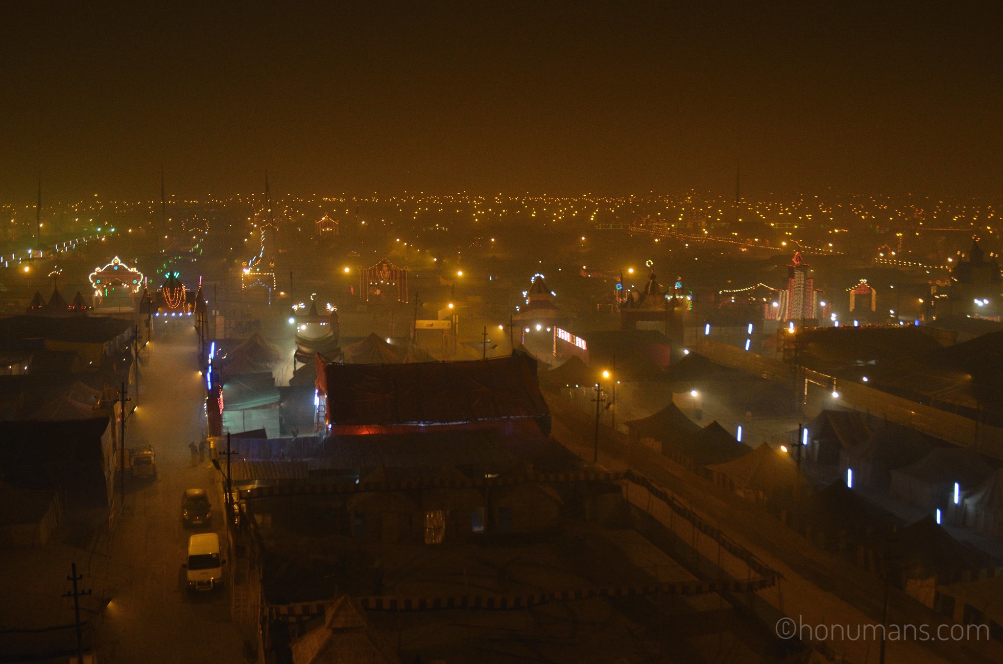
Out of three up lanes, only one was having traffic towards Varanasi. Rest all had pilgrims walking their away on the rest five lanes in the opposite direction towards Allahabad. It was Saturday midnight (Sunday) and Sunday was the day of Shahi Snan (Holy Bath) on the Maha Kumbh. God was calling and his/her followers were answering to the call.
Here is our view of Maha Kumbh.
Those 6 kms were covered in the next six hours and we reached our hotel gate in Varanasi at 6.30am on Sunday. We drove through the serpentine line of trucks on the highway, took the wildest detour to cut left from the highway into a village road in dense fog by following another tourist car. At one point in time, there was no road ahead and we just switched on our headlights and waited to discover what lay ahead. By sheer luck, we found a railway signal crossing, beyond which were the local streets of Varanasi.
The Realizations
- There was another road from Bandhavgarh to Varanasi, at least 100 kms less and didn’t touch Rewa. We were advised by the hotel staff at Bandhavgarh not to take it. Honestly, it wouldn’t have made much difference.
- Google Maps in 2012 was way behind what we see today with almost real time traffic data. We did have MMI but the situation wouldn’t have been different.
- We should have factored in the impact of Maha Kumbh crowd as seven days back we were in Allahabad itself at the start of the trip.
Pro Tip:
1. If you are driving through and through National Highway, it could take around 10-12 hours to cover 700 odd kms under normal traffic conditions.
2. If you are driving mainly through State Highways, in the same 10-12 hours, you may cover just 400 odd kms under normal traffic conditions.
3. Thorough research of all legs in the travel period is required. Here we did almost everything barring that stretch from Rewa to Varanasi and that hit us hard!
So that’s how our most memorable and excruciating #travelfiasco happened on the road. Isn’t that obvious, after you have read the most intricate details of a road-trip which happened 8 years back and is being documented for the first time? 😀


That was quite an experience! I am hooked to your travelogues. It seems to be a gold mine.
LikeLiked by 1 person
Bet it was and what’s road trip without its fair share of unwanted situations! 🙂
There are few other as well. Let us know how you like them. Thanks for coming here and sharing your thoughts.
LikeLike